Philippines

Thursday, July 23, 2009

SPECIAL PRAYERS


Father, in the Name of Jesus, bless me while I'm reading this and open doors in our lives today, Save and set us free!

Give us a double portion of your Spirit as we take back everything that the devil has stolen:

> ****Emotional Health
> ****Physical Health
> ****Finances
> ****Relationships
> ****Children
> ****Jobs
> ****Homes
> ****Marriages

I cancel every plot, plan and scheme the enemy has devised against us in the NAME OF JESUS.

And I declare:
NO WEAPON FORMED AGAINST US WILL PROSPER. I speak LIFE into every dead situation. And, I thank you that nothing is over until YOU say it's over! Speak prophetically into our lives and to our situations:

> ****our households are blessed;
> **** our health is blessed;
> **** our marriages are blessed;
> **** our finances are blessed;
> **** our relationships are blessed;
> **** our businesses are blessed;
> **** our jobs are blessed;
> **** our children are blessed;
> **** our grandchildren are blessed;
> **** our parents are blessed;
> **** our siblings are blessed;
> **** our ministries are blessed;
> **** our decisions are blessed;
> **** our friends are blessed.

Mortgages are paid and debts canceled; our hearts' desires are on the way;

According to YOUR perfect will and plan for our lives.

YOU SAID YOU'D NEVER FORSAKE US! IN JESUS' NAME!

AMEN!

Sunday, July 09, 2006

Explore Philippines (Laguna)


Laguna - Resort Province Of The Philippines


Description
Laguna, Resort Province of the Philippines, is a haven of fresh and pristine bodies of water such as hot springs, lakes, and waterfalls. Most notable is Pagsanjan Falls, formerly called Magdapio Falls, referred to as “shooting rapids.” It is found in Cavinti, starting from Pagsanjan town. Another is Lake Caliraya, which is located between Cavinti and Lumban. The strong mountain breeze that blows from the Sierra Madre Mountain Ranges and the distant Mount Banahaw makes the lake an ideal place for aqua sports like wind surfing, water skiing, sailing as well as game fishing. Laguna de Bay, Southeast Asia’s largest fresh water lake, stays pristine throughout the year due to regular rain showers.

Innumerable hot springs abound in the province, including the famous Hidden Valley Springs which is located in a secluded part of Alaminos town. A trip to Dalitiwan River, located in Botocan, Majayjay, is an exciting adventure because the terrain is rugged, as mountain lands go, and the cool water or river gushes through the rocks and boulders along the watercourse in sweeping currents. The mystical Mt. Makiling in Los Baños is an inactive volcano, rising to about 1,109 meters above sea level. It is indeed endowed with nature’s beauty, making it ideal for all types of nature tripping, from trekking to bird and butterfly watching and even camping.

Laguna is not only endowed with natural wonders. It also plays an important role in the country’s history as the birthplace of Dr. Jose Rizal, the country’s national hero, whose infancy and early manhood were spent in the towns of Calamba and Biñan. A number of churches of Spanish-influenced architecture in intricate Romanesque and Baroque design, mostly restored to their original elegance, are also found in the province.

The province is one huge showcase of Southern Tagalog craftsmanship. The town of Paete is famous for its woodcarvings, papier mache, and handmade paper products.Tree seedlings, sampaguita flowers, orchids, and exotic plants are big business. Cut flower farms are found mostly in towns of Calamba, Los Baños, and Bay. Sweet tropical fruits abound, such as the lanzones from Paete, pineapple from Calauan, chico, banana, mango, rambutan, and avocado. Add to these Laguna’s embroidered garments. Jusi cloth made from banana fiber is painstakingly, albeit deftly, transformed into beautiful pieces of clothing worthy of being tailored into the Philippine national costume, the Barong Tagalog. Shoes made from abaca hemp is a growing industry in the town of Liliw.

Owing to its nearness to Manila, Laguna is presently becoming the center of economic activity in the Southern Tagalog Region and the CALABARZON area. Business in the area is bustling as shown by the presence of several industrial estates designed for handling large scale firms engaged in textile manufacturing, electronics, food processing, industrial machines, and car assembly.


Geography
Laguna is situated 30 kilometers south of Manila and has a total area of 175,973 hectares. Laguna is bounded on the north by the province of Rizal, on the east by the Sierra Madre Mountain Ranges, on the south by the Quezon province, on the west by Laguna de Bay, and the provinces of Batangas and Cavite.

Climate
Laguna has no pronounced seasons. However, it is relatively dry from November to April and wet from May to October. Climate is generally cool and gentle, even during the summer months. Rainfall is evenly distributed throughout the year in the eastern and southern portions of the province, giving rise to an abundance and variety of flora and fauna.

Population
Laguna has a total registered population of 1,747,000 based on the May, 2000 National Statistics Official Survey. The people of Laguna are known to be hardworking, highly motivated, good-natured, and friendly.

Language / Dialects
Laguna being part of the Southern Tagalog Region, approximately 99.22% of the population speak Tagalog. A minority of the population also speak Ilokano, Bicolano, and Waray. A significant portion of the working population can read and speak English and Filipino.

Explore Philippines (Cavite)


Cavite - A Place With A Glorious Past


Description
The province of Cavite abounds with great objects, and subjects, of culture and history. It is the birthplace of a good number of Filipino heroes and it has an interesting range of sites associated with the Philippine Revolution of 1896. Found in the province is the residence of the first president of the republic, Emilio Aguinaldo, which is also the site where the Philippine Republic was proclaimed on June 12, 1898.

A province not constrained with living in the past, Cavite teems with natural resources and fantastic landscapes. It is home to Tagaytay City, the Philippines’ second summer capital, next to Baguio City. The accessing highway offers a breathtaking sight of the world-famous Taal formation, a crater within an island within a lake. Coconut groves dot the ridges of Tagaytay and classy accommodations give the visiting tourists the pleasures of relaxation, and at the same time, wide opportunities to enjoy the magnificent view of Taal.

Yet Cavite stands proudly as a place with a glorious past. Its warm and friendly people, whose ancestors fought for a noble cause, manifest industry and patience in various skills and professions, openly receptive to the entry and exchange of culture and technology that are of value to this wondrous province.

GEOGRAPHY
Cavite province lies at the southwest entrance of Manila Bay across the Bataan Peninsula, extending eastward along the shore line up to the historic Zapote Bridge, and the inland terrain in the south, to the municipality of Carmona. It is bounded on the east by the provinces of Rizal and Laguna, on the south by the province of Batangas, on the west by the South China Sea, and on the north by Manila Bay and the city of Manila.

CLIMATE
Cavite has two pronounced seasons – the dry season, which usually begins in November and ends in April, and the rainy season, which starts in May and ends in October. Cavite’s cool periods are from December to February while summer months are from April to May.

POPULATION
The province of Cavite has a population of 1,907,000 as of May 2000.

INDUSTRIES
Cavite’s 805,800-strong labor force comprises 54.12% of the provincial household population, 15 years old and above, and most of them are in agriculture, forestry, fishing tourism, trade, and industry. Underemployment rate is 9.66% while literacy rate stands at a high 98%, making the province a reliable source of proficient, skilled, and semi-skilled labor force.

LANGUAGES/DIALECT
Majority speak Tagalog while those in Cavite City and in some areas speak Chabacano. English is considered as the second language and is widely used as medium of communication in business and higher education. Other indigenous languages are Waray, Bicolano, Cebuano, Ilokano, Pangasinense, and Hiligaynon. Chinese and Spanish are also spoken by some local residents.

POLITICAL SUBDIVISION
The province of Cavite has three cities and 20 municipalities. The provincial capitol is located in Imus but the seat of the provincial government is Trece Martires, provincial capital. The three cities are Cavite, Trece Martires, and Tagaytay. The municipalities are Alfonso, Amadeo, Bacoor, Carmona, Dasmariñas, Gen. Aguinaldo, Gen. Alvarez, Gren. Trias, Imus, Indang, Kawit, Magallanes, Maragondon, Mendez, Naic, Noveleta, Rosarion, Silang, Tanza, Ternate.

Thursday, July 06, 2006

Explore Philippines (Batangas)


Batangas - From The Lowest Volcano To Deeper Dives


BRIEF DESCRIPTION
A province that is famous for excellent dive sites and the world’s lowest volcano, Batangas is going nowhere but up. It is a thriving tourist destination replete with open beaches and sheltered coves, subterranean caves and deep harbors, a preserved heritage and brave men in history.

Found in the province is world-known Anilao and its many dive sites that are ideal for poking around and observing marine life, and outstanding for macro photography. Multi-hued crinoids are prolific. The variety of nudibranchs is unmatched. Night dives are especially nice and often reveal unusual creatures like sea hares, sea goblins, catfish eels, ghost pipe fishes, blue-ringed octopuses, mandarin fishes, and snake eels. The area’s best known dive site, coral-covered Cathedral is spectacular at night. One of the prettiest dives in the area, Sepok has nice coral gardens and a vertical wall.

Taal Lake and Volcano in Batangas is Southern Luzon’s centerpiece attraction. Known to be the smallest in the world, it is a volcano within an islet within a lake within a crater within a volcano. The town of Taal reigns as one of the two most culturally preserved sites of the Spanish colonial era; the other is Vigan in Ilocos Sur. The village in Taal conforms to the old town layout combining the municipal hall, school, church, and houses.

Among the multitude of popular tourism activities to be had in the province are heritage tours, pilgrimage tours, scuba diving, shopping, mountain climbing and trekking, swimming, and snorkeling. Batangas is located only 110 kilometers south of Metropolitan Manila, and is very accessible from the national capital by land.

GEOGRAPHY
The province of Batangas is bounded on the north by the provinces of Cavite and Laguna, on the south by the Verde Island passage, on the east by the provinces of Quezon and Laguna, and on the west by the South China Sea. It has a total land area of 316,580 hectares, 50% of which has a grade of less than 15 degrees. The terrain is generally rolling while the rest are mountainous and hilly.

CLIMATE
Batangas has a naturally cool climate. It experiences two types of seasons: dry from November to April and wet for the rest of the year. Mean annual rainfall is at its maximum in July, at 1.5 to 2.5 meters. March is the driest month. Mean monthly temperature is 82 degrees Fahrenheit. February is the coldest month, averaging 69 degrees Fahrenheit, while May is the hottest, at 96.1 degrees Fahrenheit.

POPULATION
The population of the province totals 1,905,348 as of May 2000.

LANGUAGE / DIALECTS
Batangueños are bilingual, with Tagalog and English as the basic languages used in business, government, schools, and everyday communication.

POLITICAL SUBDIVISION
The province is composed of 32 municipalities. Capital is Batangas City.

Explore Philippines (Aurora)


Aurora - Sanctuary Of Nature's Splendor


Brief Description
Beyond the lush forest of the Sierra Madre mountains lies a splendid land so unbelievably rich and untouched - Aurora, otherwise known as the “Sanctuary of Nature’s Splendor.”

The Sierra Madre mountain range covers a large part of the province of Aurora. In fact, next to the Aurora coastline, it is the place where flora and fauna are most concentrated. Waterfalls, rivers, crystal clear streams of varying sizes are located within, if not adjacent to, the area of the Sierra Madre mountain. Special interest trips such as mountain climbing, safari, bird watching, ecological studies, or even as simple as picnics could be rolled into one by taking the trails recommended by local nature trekkers in the area.

When the northeast monsoon winds blow and the usual tranquil white beaches are transformed into deathtraps by angry waves, it is time to come to Aurora to ride the waves on a surfboard.

Geography
Aurora has a total land area of 308,122 hectares. Its main link to the rest of Luzon is a narrow mountain gravel road twisting across the Sierra Madre mountain ranges between Baler and the municipality of Bongabon in Nueva Ecija.

Political Subdivision
Aurora is composed of eight municipalities, with Baler as the provincial capital.

Climate
The climate is characterized by rainfall, which is more or less evenly distributed throughout the year. Because the province faces the Pacific Ocean, it is regularly battered by typhoons coming from the east.

Population
Based on the national statistics survey of May 2000, Aurora has a population of 173,797 with an annual growth rate 1.84%.

Language / Dialect
The province speaks predominantly Tagalog, and in some parts, Ilocano. The working population is fluent in both the English and Filipino languages.

Major Industries
Aurora’s basic economy is agricultural; copra and rice are the principal products. Weaving, especially of buntal hats, is an important cottage industry.

Fishing production can be increased in Casiguran Sound and Dingalan Bay but Baler Bay’s is expected to diminish due to over-fishing and sedimentation.

Aurora has maintained its forest cover but is under serious threats from logging.

Isolation, inaccessibility, and exposure to typhoons have hampered the province’s development.

Explore Philippines (Bataan)


Bataan - History Hub Of Central Luzon


Brief Description
Discover the magic of the Philippines’ Third Region with this amazing historical and cultural province, only an hour by ferryboat across the bay from Manila. Until recently not a traditional tourist destination, Bataan is now proving to be a tourist haven boasting a multitude of exciting places to visit, and interesting things to do. The province has much to offer – a rich culture and history, the beauty of unspoilt beaches, and a warm hospitality that is truly Filipino.

Geography
Bataan is the peninsula in the western part of Luzon that shields the Manila Bay on its south and east from the South China Sea on its west. Zambales and Pampanga form its boundaries on the north.

Political Subdivision
Balanga City, 124 km. from Manila, is the provincial capital. The twelve towns lying in its coast integrade 238 barangays and 11 cultural minorities or sitios.

Climate
The climate consists of two distinct seasons: dry from November to April and wet during the rest of the year.

Population
The population of Bataan for the year 2000 was 552,000 based on the growth rate of 2.12% in Central Luzon.

Language / Dialect
Tagalog is the main language and is widely used, followed by Pampango and Ilocano. English is used mostly as the medium of transaction in business.

Major Industries
Bataan remains basically an agricultural province in spite of the rapid industrialization during the last decade. Mariveles is the site of an export-processing zone that accounts for heavy industry in the province. Cattle and carabao fattening, hog raising, and poultry industry, especially broilers and ducks and egg production, are some of the promising livelihood programs in the province.

Explore Philippines (Zambales)


Zambales - Wreck Diving Capital Of The Philippines


BRIEF DESCRIPTION
Zambales has been gifted with the natural beauty of its surroundings. It has been touched by civilization yet has maintained its rustic glory and beauty. The Zambales coastline is most famous for its sandy beaches and deep blue sea teeming with coral reefs.

The province is historical. Located here is the ancestral house of the most beloved Philippine President, Ramon Magsaysay, situated at Castillejos. Mt. Pinatubo, world-famous for its 1991 catastrophic eruption, can be found in the vicinity.

Zambales is perfectly suited for visitors seeking an authentic view of the Philippines without going too far from the national capital, Manila. It is located at the western part of Luzon, 210 kilometers or approximately a three-hour drive from Manila.

Geography
The province has a few lowlands along the narrow coast where the town centers are located. The northern part is basically swampy. Mountain ranges containing most mineral deposits as well as some volcanoes are found in the eastern portion.

Political Subdivision
Zambales has 13 towns and one city, with Iba as the provincial capital.

Population
Zambales has a population of 561,554.

Language/Dialect
Tagalog is the predominant dialect followed by Ilocano and Zambal. English is widely spoken.

Climate
There are two pronounced seasons: dry from November to April, and wet during the rest of the year.

Major Industries
Zambales is basically an agricultural province. The chief products are rice, corn, vegetables, and rootcrops. Major industries include farming, fishing, and mining.

The Olongapo area, once the site of the biggest U.S. naval base in Asia, is fast developing into an industrial and tourism zone under the Subic Bay Metropolitan Authority.

Explore Philippines (Tarlac)


Tarlac - Melting Pot Of Central Luzon


BRIEF DESCRIPTION
Tarlac is the most multicultural of the Central Luzon provinces. A mixture of four district groups, the Pampangos, Ilocanos, Pangasinenses, and Tagalogs, share life in the province.

Tarlac is best known for its fine foods and vast sugar and rice plantations. That it has fine cooking to offer is due largely to the fact that it is the melting pot of Central Luzon. It offers some of the best cuisines from the places of ancestry of its settlers, the provinces of Bulacan, Nueva Ecija, Zambales, Pangasinan, and the Ilocos Region.

Historical sites, fine food, vast plantations, a beautifully landscaped golf course, and so many other attractions – all these make the province of Tarlac one of the best of the places to visit in Central Luzon.

Geography
The province is situated at the center of the Central Plains of Luzon, landlocked by four provinces: Nueva Ecija on the east, Pangasinan on the north, Pampanga o the south, and Zambales on the west. Approximately 75% of the province is plain while the rest is hilly to mountainous.

Political Subdivision
Tarlac is divided into three congressional districts with 18 towns and an aggregate of 510 barangays.

Population
Tarlac has a population of 859, 222.

Language/Dialect
Ilocano is spoken by half of the population followed by Pampango spoken by 41%. Everybody understands the Tagalog language.

Climate
Like the rest of Central Luzon, the province has two distinct seasons: dry from November to April and wet for the rest of the year.

Major Industries
Principal crops are rice and sugarcane. Other major crops are corn and coconut; vegetables such as eggplant, garlic, and onion; and fruit trees like mango, banana, and calamansi.

Because the province is landlocked, its fish production is limited to several fishponds. On the boundary with Zambales in the west, forestlands provide timber for the logging industry. Mineral reserves such as manganese and iron can also be found along the western section.

Tarlac has its own rice and corn mills as well as sawmills and logging outfits. It has three sugar centrals. Other firms service agricultural needs such as fertilizer. Among its cottage industries, ceramics making has become important because of the abundant supply of clay.

Wednesday, July 05, 2006

Explore Philippines (Pampanga)


Pampanga - Culinary Center Of The Philippines


BRIEF DESCRIPTION
Steeped in history and blessed with natural and man-made scenery, Pampanga offers several sightseeing options for visitors. Pampanga has always enjoyed the title, “The Culinary Center of the Philippines.” It is populated by resourceful hardy folk who are justifiably proud of their famous Kapampangan cuisine.

The capital city of San Fernando is world-famous for its annual Easter re-enactment of the crucifixion of Jesus Christ. It is also famous for the Pampanga Christmas lanterns.

The province has remnants of a long and colorful history. It houses a booming night life and tourist destinations. It is the site of world-class resorts, casinos, duty free shopping, and golf courses.

Geography
Pampanga is located in the central part of Central Luzon. It is bounded on the north by Tarlac and Nueva Ecija, Bulacan on the east, on the south by Bataan, and on the west by Zambales. The province’s total land area is 218, 068 hectares or 2, 180.68 square kilometers.

Political Subdivision
Pampanga is composed of 20 municipalities and two cities, namely: Angeles City and San Fernando City. It is subdivided into four political districts.

Population
The province has a population of 1, 529.246.

Language/Dialect
Kapampangan, English, and Tagalog are spoken and understood anywhere in the province.

Climate
Pampanga is characterized by a wet season and dry season.

Major Industries
Farming and fishing are the main industries. Rice and sugarcane are the major crops. Others are banana, mango, and eggplant. The rivers and fishponds produce fish, shrimps, and crabs.

Tuesday, July 04, 2006

Explore Philippines (Nueva Ecija)


Nueva Ecija - Rice Bowl Of The Philippines


BRIEF DESCRIPTION
Nueva Ecija is the largest province and the biggest rice producer of Central Luzon, thus, often referred to as the “Rice Bowl of the Philippines.”

Among its main attractions is the Pantabangan River, the country’s first multi-purpose infrastructure, which stands today as a phenomenon in Filipino engineering feats. Another is the Pampanga river, cutting across a rich valley floor, famed for irrigation, the generation of hydroelectric power, and the mitigation of flood damage.

Nueva Ecija is also the agri-tourism pilot site in Central Luzon due to the presence of the Central Luzon State University in the province.

Its other worthwhile attractions include the Minalungao National Park, Rizal Hot Spring, Burburayok Springs and Pajanutic Falls, Barrio Puncan in the town of Carranglan, among others.

Geography
The province is the largest in Central Luzon. Its terrain begins with the southwestern marshes near the Pampanga border. It levels off and then gradually increases in elevation to rolling hills as it approaches the mountains of Sierra Madre in the east, and the Caraballo and Cordillera ranges in the north.

Political Subdivision
The province is divided into four congressional districts, which consists of 28 municipalities and four cities, namely: Cabanatuan, San Jose, Palayan, and Science City of Muñoz. The provincial capital is Palayan City.

Population
According to the NCSO, Nueva Ecija has a population of 1,310,829 of which 13.16% are concentrated in Cabanatuan City. The rural population totals 799,280 while the urban population is 511,549.

Language/Dialect
Tagalog is predominantly spoken by the Novo Ecijanos, comprising 67.7%, followed by the Ilocano dialect at 29.93%. Other dialects are Pampango, Pangasinan, Bicol, and Ilonggo.

Climate
Nueva Ecija has two pronounced seasons: the wet or rainy season from May to November and the dry season during the rest of the year.

Major Industries
Nueva Ecija is one of the top producers of agricultural goods in the country. Its principal crops are rice, corn, and onion. The province is often referred to as the “Rice Bowl of the Philippines.” Other major crops are mango, banana, eggplant, and garlic.

Fishponds are unevenly distributed throughout the province but the largest concentrations are in San Antonio, Sta. Rosa, and Cuyapo.

Several areas have mineral deposits. Copper and manganese have been found in Gen. Tinio, Carranglan, and Patabangan. The upper reaches of Carranglan and Palyan are said to contain gold.

Explore Philippines (Bulacan)


Bulacan - Land Of Heroes


Description
Feel the heart and soul of the Philippines in Bulacan. Its history and tradition, its land, its culture, and its people, live and breathe Filipino. Truly a melting pot of the past and the present, the old and the new, the countryside and the urbane – that is Bulacan.

The province is noted as the land of heroes. Bulacan is the home province of some of the nation’s celebrated heroes: Francisco Baltazar (Balagtas), “The Prince of Filipino Poets,” Marcelo H. Del Pilar, “The Great Propagandist,” and Gregorio del Pilar, “The Hero of Tirad Pass.” It is reputed for beautiful women, progressive cooperatives, small and medium scale industries. It is known for excellent craftsmanship as in its jewelries, leather crafts, and garments.

The province has emerged into a reputable resort haven of Luzon. Just a few minutes north of Manila by car, Bulacan resorts provide an accessible and welcome respite from the pressures of city life.

Geography
Bulacan is in the southwestern part of Central Luzon. It is bounded on the north by Nueva Ecija, on the east by Aurora and Quezon, on the west by Pampanga, and on the south by Rizal, Metro Manila, and the Manila Bay.

Political Subdivision
Bulacan consists of 24 towns, with Malolos City as the provincial capital.

Population
Bulacan’s population is 1,502,343 and still growing.

Language/Dialects
The language used in the province is predominantly Tagalog. Other dialects used by the townfolks are Waray, Ilocano, Bicolano, and Kapampangan.

Climate
Like the rest of Central Luzon, Bulacan’s climate consists of two pronounced seasons: dry from November to April and wet for the rest of the year.

Major Industries
The province of Bulacan is veering away from being an agricultural area and becoming an industrialized one. Its proximity to Manila gives it the advantage of being a favored site of industrial establishments, including leather tanning, cement bag making, ceramic textiles, food processing, shoe making, and many others.

The majority of the rural areas, however, are still dependent on agriculture for their livelihood. Rice is the principal crop, followed by corn, vegetables, and fruits.

Explore Philippines (Batanes)


Batanes - Land Of The True Insulars


Brief Description
The island-province of Batanes was created by a series of volcanic activities and other geologic forces millions of years ago.

The province is home to the famous Ivatans who are nationally acclaimed as the “True Insulares.” The Ivatans are of Malay stock, tracing their roots to early immigrants from Formosa, Taiwan as well as Spaniards who came to the island in the 16th century. Being an insular people, the Ivatans have kept the purity of their gene pool through time.

Batanes lies at the northernmost tip of the Philippines, where the Pacific Ocean merges with the South China Sea. It is composed of three major islands, namely: Batan which contains the capital town of Basco, Sabtang, and Itbayat. Close by are seven islets including Amianan, which is the closest to Formosa. Thus, Batanes has been identified as the country’s potential gateway to East China.

Geography
"The island-province is strewn on a 4,500 square kilometer expanse of territorial waters, the Luzon Strait and Balintang Channel, where the Pacific Ocean merges with the South China Sea, a sealane between the Philippines and the southern parts of Japan, China, Hongkong, and Taiwan. It is bounded on the north by the Bashi Channel, on the east by the Pacific Ocean, on the west by the South China Sea, and on the south by the Balintang Channel. It is characterized by gently rolling hills, cliffs, and black and white sand beaches.

Batanes is about 860 kilometers (approx. 525 miles) from Manila. Basco, the capital town, is about 280 kilometers north of Aparri and about 190 kilometers south of Taiwan.

Political Subdivision
Batanes has six municipalities, 29 barangays, and one congressional district. The six municipalities are Ivana, Uyugan, Mahatao, Basco (the capital), and the island municipalities of Sabtang and Itbayat.

Climate
The Batanes weather is rather pleasant. Compared to the rest of the country, Batanes is blessed with a cooler, balmier climate. It enjoys practically four seasons, the best one being summer which is from March to June. Average monthly rainfall is 450 mm.

Population
The 2002 census of population for Batanes registered a population total of 16,467 distributed over a land area of 230 square kilometers.

Language / Dialect
The mother tongue of Batanes is Ivatan, spoken by 93.94 percent of all households. The Ilocano dialect is also spoken while Filipino and English are generally spoken and understood.

Major Industries
The province has a total agricultural land area of 5,438 hectares and has a wide area open for agricultural expansion. Due to its terrain, it is a major livestock producer with cattle as its main stock. Carabaos and goats are also popularly raised. Another major industry is fishing which reaches its peak during the summer months, from March to June, when the seawater is relatively calm.

Explore Philippines (Quirino)


Quirino - Forest Heartland Of Cagayan


Brief Description
Long before its formal creation as an independent province, Quirino was the forest region of the province of Nueva Vizcaya, inhabited by tribal groups known as the Negritos. They roamed the hinterlands and built their huts at the heart of the jungle.

Quirino lies in the southeastern portion of Cagayan Valley. It is situated within the upper portion of the Cagayan River basin and bounded by Isabela on the north, Aurora on the east and southeast, and Nueva Vizcaya on the west and southwest.

The Ilocano dialect is used widely in the lowlands of the province’s various municipalities while Ifugao is predominant in the uplands.

Geography
The Sierra Madre Mountain Range provides a natural barrier on the eastern and southern border of the province and the Mamparang Range on the western part. The province is generally mountainous, with about 80 percent of the total land area covered by mountains and highlands. A part of the province’s comparative advantage is its accessibility to the town of Aurora.

Political Subdivision
Quirino has six municipalities: Cabarroguis, the capital town, Saguday, Diffun, Maddela, Nagtipunan, and Aglipay. The province has one congressional district and 110 barangays.

Population
The population of the province as of the year 2000 census of population was 148,575, with a density of roughly 49 persons per square kilometer of land.

Language/ Dialect
The major dialect is Ilocano, spoken by 71.46 percent of the total populace. Other dialects are Ifugao, Bugkalot, Pangasinense, and Kankanai.

Climate
The province has a mean annual temperature of 26.6 degree Celsius. Warmest month is May and the least dry months are March to August while the rest of the year is neither too dry nor too wet. Rainy days occur from September to November.

Industries
Agriculture is the main industry with rice and corn as major crops. These supply the demand of neighboring provinces and the metropolis. Banana as well as banana chips are major products sold in Metro Manila and Pampanga. Small scale industries like furniture making, basketry, rattan craft, and dried flower production are prevalent.

Explore Philippines (Nueva Vizcaya)


Nueva Vizcaya - Watershed Haven Of The Valley


Brief Description
The history of Nueva Vizcaya could still be reflected from the culture and customs of its early settlers, which included the Ilongots (now called Bugkalots), Igorots, Ifugaos, Isinais, and Gaddangs. The influx of civilization and the infusion of modern technology to the lifestream of the province induced many immigrants from the adjacent provinces, primarily Ilocanos, Tagalogs, Pangasinenses, Kapampangans, among others.

Located about 268 north of Metro Manila, the province is tagged to be the new alternative destination for outdoor and environment enthusiasts. Considered a watershed haven, it is 70 percent forestland. It is strategically bounded by the Sierra Madre Mountain Ranges, Caraballo Mountains, and Cordillera Mountains. It is also the gateway to the Cagayan Valley Region and the Banaue Rice Terraces, eighth Wonder of the World.

Geography
Home of the Isinais, Nueva Vizcaya is located in the northcentral part of Luzon in Region 2. It is surrounded by notable mountain ranges such as the Sierra Madre on the east, Caraballo on the south, and Cordillera on the west. The province has several principal rivers: Magat, Matuno, Marang, Sta. Fe, and Sta. Cruz. All these rivers are tributaries of the Magat River which flows into the Cagayan River. The province is bounded on the north and northeast by the province of Ifugao and Isabela, on the east and southeast by Qurino and Aurora, on the south by Nueva Ecija, and on the west by Benguet and Pangasinan.

Political Subdivision
The province is considered as one congressional district and has 15 municipalities and 274 barangays. Bayombong is the provincial capital while Solano and Kayapa are its commercial and summer capital, respectively

Population
The year 2000 census of population for Nueva Vizcaya was registered at 366,692.

Language/Dialect
The majority of the people speak Ilocano, comprising 66.9 percent of households.

Climate
Nueva Vizcaya is relatively dry from November to April and relatively wet during the rest of the year. Maximum temperature ranges from 22-25 degrees Celsius. December and January are the coldest months when temperature falls to about 20 degrees Celsius while the warmest months are April and May. Nueva Vizcaya is often referred to as lowland Baguio because of its pleasant climate.

Industries
The province has basically an agricultural economy with commerce, trade, and industry contributing to its growth and development. Among other major economic activities are farming and cattle and swine raising. Primary crops are palay and corn. Minor crops are rootcrops, vegetables, and fruits. The province produces quality onions and vegetables often sold in Metro Manila. Oranges and mangoes are now major crops being exported fresh to Asian countries.

Explore Philippines (Isabela)


Isabela - Rice Granary Of The North


Brief Description
Isabela, the biggest province in the Cagayan Valley Region, is now one of the premier provinces of the north. It has been dubbed as the “Rice Granary of the North” having been adjudged as the Most Outstanding Province in Food Security in the Gawad Sapat Ani Awards 2000 conducted by the Department of Agriculture. It is also home to the famous Northern Sierra Madre Natural Park, a protected seascape and landscape of exceptional biodiversity.

Santiago City, the commercial center of Region 2, has been declared an independent-component city through a plebiscite on July 3, 1994 under Republic Act 7720.

Cauayan City, the trading center in Isabela, is also a component city ratified in a majority vote on March 30, 2001.

Geography
The province is divided into three physiographic areas. The eastern area, straddled by the Sierra Madre Mountain Range, is rugged and thickly forested. A substantial portion is uncharted and the unexplored hinterlands are home to a rich variety of flora and fauna while others are government reservations. The western area is a sprawling fertile valley hemmed by the Central Cordillera and is criss-crossed by the mighty Cagayan, Siffu, and Magat Rivers. Its mountains rise to a peak of about 8,000 feet and is home to one of the world’s largest remaining low-altitude rainforests with numerous unknown endemic species of flora and fauna and exceptional biological diversity. The area is popularly known as the Northern Sierra Madre Natural Park.

Isabela comprises an aggregate land area of 10,665 square kilometers, representing almost 40 percent of the regional territory. It is the largest province in the region and the second largest province in the country in terms of land area.

Political Subdivision
The province has 35 municipalities and 1,055 barangays and is divided into four congressional districts. Santiago is an independent-component city while Cauayan is a component city. Ilagan is the capital town while Cauayan is the industrial center.

Population
Based on the year 2000 census of population, the province has a population of 1,287,575 with a population density of approximately 120.73 persons per square kilometer.

Language/Dialect
The major dialect in Isabela is Ilocano followed by Ibanag, Yogad, and Gaddang. People, especially in the capital and commercial centers, speak and understand English and Pilipino.

Climate
Generally, the province has two types of climate. The eastern and coastal areas experience moderate rainfall more or less distributed throughout the year while western Isabela has more pronounced wet and dry seasons. The average temperature is recorded at 27.1 degrees Celsius.

Industries
Agriculture is the major industry of the people of Isabela. Farming is highly mechanized as most of the agricultural lands are irrigated. With the presence of the Isabela State University, joint ventures and other foreign assisted projects are viable while the Magat Dam Tourism Complex contributes to the high productivity in agriculture. Isabela is acknowledged as the hub of trade and commercial activities in the region due to its central location in the region. Furniture making using narra and other indigenous forest materials/products like Gmelina continue to exist. Potential investments are in fisheries and tourism. The reservoir of the Magat Dam is utilized for fishcage operations, particularly tilapia production. Tourism is relatively a new industry being developed in the province especially in the coastal areas. Support services and accommodation facilities are likewise being developed.

Explore Philippines (Cagayan)


Cagayan - A True Spelunker's Paradise


Brief Description
Cagayan is the Regional Seat of the Cagayan Valley Region.

Tuguegarao City, the capital, is the seat of commerce and trade and center for learning. The province has 73 percent of the region’s potential fishing area.

Known as the spelunker’s, trekker’s, and gamefisher’s paradise rolled into one, Cagayan provides a never-ending adventure with ecotourism in the forefront of its offering. Both foreign and local tourists continue to explore its caves, engage in gamefishing expeditions, trek its mighty mountains and retreat to its centuries-old churches.

Present day chroniclers say that the name was derived from the word “tagay,” a kind of plant that grows abundantly in the northern part of the province. Thus, “Catagayan” which means a place where the tagay grows abundantly was shortened to “Cagayan,” the present name of the province.


Geography
The province is bounded by the Pacific Ocean on the east, on the south is Isabela province, on the west is the Cordillera Mountain, and on the north by the Balintang Channel and the Babuyan Group of Islands. About two kilometers from the northeastern tip of the province is the island of Palaui, a few kilometers to the west is Fuga Island. The Babuyan Group of Islands, which includes Calayan, Dalupiri, Camiguin, and Babuyan Claro, is about 60 nautical miles north of Luzon mainland.

The province comprises an aggregate land area of 9,002.70 square kilometers, which constitutes three percent of the total land area of the country, making it the second largest province in the region.


Political Subdivision
Cagayan has 28 municipalities and one city divided into three congressional districts. It has 816 barangays. Tuguegarao City (as of December 18, 1999) is the provincial capital, regional seat, and center of business, trade, and education. It has a land area of 144.80 square kilometers and a population of 120,645 as of 2000.


Population
Cagayan has a total population of 993,580 as of the year 2000 census of population, or 110.36 persons per square kilometer.


Language
Languages in the province are Ybanag, Ytawit, Malaweg, and Ilocano. Other ethnic groups that migrated to the province speak their own dialects. People in places where literacy is high speak and understand English and Pilipino.


Climate
Seasons in the province are not very pronounced. Relatively dry season occurs during the months of March to June and rainy season from July to October, although it is relatively cold during the months of November to February.


Industries
Agricultural products are rice, corn, peanut, beans, and fruits. Livestock products include cattle, hogs, carabaos, and poultry. Fishing various species of fish from the coastal towns is also undertaken. Woodcraft furniture made of hardwood, rattan, bamboo, and other indigenous materials are also available in the province.

Explore Philippines (La Union)


La Union - Pilgrimage Center Of North Luzon


Description
Situated on the northwestern coast of Luzon, La Union is the gateway to the Ilocos Region. With its strategic location, the province has become the business, education, and government center of the Ilocos. Not only is La Union the region’s center for trade but also of religious devotees who flock to one of the country’s popular pilgrimage destinations, especially during Lent.

Agoo, the oldest town of La Union, was once the site of the much publicized divine visitations of the Virgin Mary. The Agoo Apparition Site in San Antonio has established the town as a destination of choice for Marian devotees. Agoo comes alive most on Semana Santa, or the Holy Week, which is the week before Easter. Yearly, the townspeople bear witness to ardent devotees relentlessly pulling life-size statues depicting the 14 Stations of the Cross along the processional roads in Agoo during the Good Friday procession on Semana Santa.

But the province is not wanting of natural attractions, thanks to seascapes that make it a watersports paradise. The surf fronting Monaliza in Urbiztondo, San Juan is the best site for board surfing from November to February; other good sites are in Carlatan and Wallace in San Fernando. Scuba diving is ideal in Fagg Reef, which is adorned by sharks, barracuda, sea snakes, Moray eels, and other friendly sea creatures, and Research Reef, which is endowed with several tunnels, caverns, and crevices.


Geography
La Union is located in the southwestern part of Region I and stretches over a length of 102 kilometers from North to South between 120o16' and 120o35' longtitude and 160o15' latitude. It is bounded on the north by Ilocos Sur, on the south by Pangasinan, on the east by Benguet, and on the west by the China Sea.

It has a land area of 149,309 hectares with a predominantly hilly terrain that gradually rises eastward from the shore. Its irregular coastal plain is narrowest in Damortis, Sto. Tomas and widest in Balaoan. Its highest peak is in Bagulin with an elevation of 1,200 feet above sea level. The province has several rivers which are short and rapid.


Political Subdivisions
La Union has 19 municipalities and one component city, which are subdivided into 576 barangays. The northern towns of Sudipen, Bangar, Luna, Balaoan, Santol, San Gabriel, Bacnotan, San Juan, and San Fernando City comprise the First District. Belonging to the Second District are Bagulin, Naguilian, Burgos, Bauang, Caba, Aringay, Agoo, Tubao, Sto. Tomas, Rosario, and Pugo.

Climate
The climate condition prevailing in La Union is dry from November to April and wet from May to October. The southwest monsoon brings about the abundant rainfall experienced during the wet season. The relatively dry season is caused by the northeast monsoon passing over the Cordillera Mountains. The average temperature is 27.21°C.

Population
Population of the province in 2000 was 657,945. The population is concentrated in the coastal municipalities. The capital San Fernando, now a component city, registered the most with 102,082. The population count showed a 2.09% increase from the previous census in 1995.

Language / Dialect
Ilocano is the common dialect. The residents of the coastal barangay of Sto. Tomas and Rosario also speak Pangasinense while the cultural communities in the towns bordering the Cordillera speak Ibaloi or Kankanaey. English and Filipino remain as basic tools of instruction in schools.

Major Industries
Agriculture remains to be the primary industry. Cottage industries are blanketweaving, basketry, bamboocraft, pottery, and broommaking. Commercial activity consists mostly of wholesale and retail business.

Explore Philippines (Ilocos Norte and Sur)


ILOCOS NORTE AND ILOCOS SUR


Ilocos Norte - The Best Of Culture And Nature


Geography

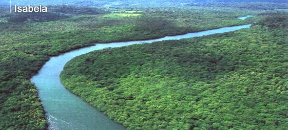
Ilocos Norte has a land area of 3,399.34 square kilometers consisting of alluvial plains, hills, mountains, coastal and miscellaneous land types. Its terrain is generally mountainous and rocky. Its coastline is dotted with coves and rivers most prominent are Bonga, Labugaon, Bacarra and Laoag. It further cuts into the coastal configurations of Bangui and Pasaleng Bay.


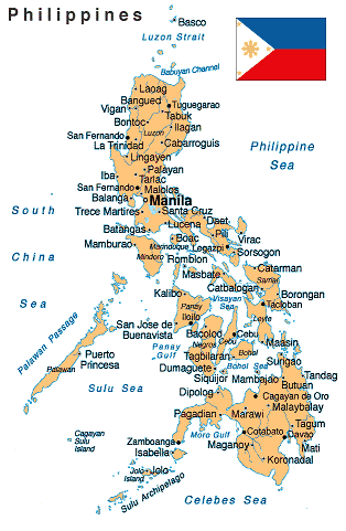
Ilocos Norte is bounded on the south by Ilocos Sur, on the east by Cagayan and Kalinga, on the southeast by Abra, and on the west by the China Sea.


Political Subdivisions
Ilocos Norte has 22 municipalities namely: Adams, Badoc, Bacarra, Bangui, Batac, Burgos, Carasi, Currimao, Dingras, Dumalneg, Espiritu, Marcos, Nueva Era, Pagudpud, Paoay, Pasuquin, Piddig, Pinili, San Nicolas, Sarrat, Solsona and Vintar. Laoag converted into a city on June 19, 1965 under R.A. 4584, remains as capital. The municipalities and Laoag City are further subdivided into 550 barangays and 2 districts.
Climate
The province experiences dry season from November to April and wet season from May to October. Annual rainfall is 2,067.2 mm. while average temperature is 27.8oC. The province is occasionally visited by tropical cyclones and storms during the southwest monsoon season.
Population


Population of the province in 2000 was 514,241. The record shows a 1.37% growth rate from the records in 1995. Laoag City had a population of 94,466.


Language / Dialect
Ilocano (Iloko) is the major dialect. English and Filipino are the tools of instruction in schools.
Major Industries


Agriculture is the main livelihood of the people. Garlic is the principal cash crop. Fishing and manufacturing are other industries. Cottage industries include weaving, pottery, blacksmithing and furniture-making.


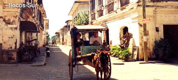
Ilocos Sur - Heritage Village Of The Philippines


Description

The province of Ilocos Sur is where the Ilocos Region’s myriad of cultures and histories converge to become a living museum of a spirited past. A national shrine, a national landmark, a national museum, heritage museums, ancestral houses, period houses, cobble-stoned streets – they all share space in the timeless land of Ilocos Sur.

Found in the province is the historic town of Vigan, which was inscribed in UNESCO’s World Heritage List in November 1999. Established in the 16th century, Vigan is the best preserved example of a planned Spanish colonial town in Asia. Its architecture reflects the coming together of cultural elements from elsewhere in the Philippines and from China with those from Europe to create a unique culture and townscape without parallel anywhere in East and Southeast Asia. Its Kamestizoan District is replete with ancestral houses with ancient tiled roofs, massive hardwood floorings, ballustrades and azoteas in varying Spanish-Mexican-Chinese architectural styles.

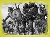
Centuries-old Sta. Maria Church, declared a National Landmark, was used as a fortress during the Philippine Revolution of 1896. Tirad Pass, declared a National Shrine, had been the last stand of the Filipino Revolutionary Forces under General Emilio Aguinaldo during the same period. Bessang Pass served as the backdoor to General Yamashita’s last ditch defense during the last stage of World War II.

Geography
Ilocos Sur is located along the western coast of Northern Luzon. It is bounded by Ilocos Norte on the north, Abra on the northeast, Mt. Province on the east, Benguet on the southeast, La Union on the south, and the China Sea on the west. Its area of 2,579.58 square kilometers occupies about 20.11 % of the total land area of Region 1.

The topography of Ilocos Sur is undulating to rolling with elevations ranging from 10 to 1,700 meters above sea level.

Political Subdivisions
Ilocos Sur has 34 municipalities which are subdivided into 764 barangays. They are Alilem, Banayoyo, Bantay, Burgos, Cabugao, Candon, Caoayan, Cervantes, Galimuyod, Gregorio del Pilar, Lidlidda, Magsingal, Nagbukel, Narvacan, Quirino, Salcedo, San Emilio, San Esteban, San Ildefonso, San Juan, San Vicente, Santa, Santiago, Sta. Catalina, Sta. Cruz, Sta. Lucia, Sta. Maria, Sto. Domingo, Sigay, Sinait, Sugpon, Suyo, Tagudin, and Vigan.

Climate
The climate is generally dry as defined by the Hernandez type of climate. Classification is characterized by more dry months usually from October to May. However, the southernmost portion (part of Cervantes) is observed to be humid and rain is evenly distributed throughout the year while the eastern part of Sugpon is dry with rain not sufficiently distributed. August has the most rainfall while January and February have the least. The mean temperature in the province is 27 degrees C. January is the coldest.

Population
In the 2000 census, the population of Ilocos Sur was 594,206. Vigan City, the capital of Ilocos Sur, has a population of 45,143. The population in the province for year 2000 increased by 1.85% relative to the 1995 census.

Language / Dialect
Filipino and English are the basic tools of instruction in schools while Ilocano is the principal dialect. Kankanaey and Itneg are spoken in cultural communities.

Major Industries
The people are engaged in farming, producing food crops, mostly rice, corn, vegetable, rootcrops, and fruits. Non-food crops include tobacco, cotton, and tigergrass. Cottage industries include loomweaving, furniture making, jewelry making, ceramics, blacksmithing, and food processing.

Philippine Sports Heroes (Part 2)

Philippine Sports Heroes (Part 2)


Mansueto Velasco


- won the silver medal in the 1996 Atlanta Olympics in the men's light flyweight division


Photobucket - Video and Image Hosting


Mikee Cojuangco-Jaworski


- the accomplished equestrienne who bagged the gold medal for the Individual Show Jumping competition in the 2002 Asian Games


Photobucket - Video and Image Hosting


Paeng Nepomuceno


- the all-time greatest international bowler with six world championships to his credit


Photobucket - Video and Image Hosting


Robert Jaworski


- one of Philippine Basketball Association’s 25 greatest players of all time. At the time of his retirement, he was the oldest professional basketball player in the world


Photobucket - Video and Image Hosting


Toni Leviste


- 2000 Sydney Olympics participant and part of the Philippine team which won the silver medal in the 2002 Asian Games showjumping competition


Photobucket - Video and Image Hosting


Akiko Thomson


- 1992 Barcelona Olympics swimming competition participant


Photobucket - Video and Image Hosting


Alvin Patrimonio


- four-time Philippine Basketball Association Most Valuable Player, two of which were won back-to-back in 1993 and 1994


Photobucket - Video and Image Hosting


Bong Coo


- made her mark in the bowling world when she delivered nine consecutive strikes in 1979. She has continued to reap honors for the country since then.


Photobucket - Video and Image Hosting


Dorothy Delasin


- the Filipina who has become the youngest Ladies’ Professional Golf Association Champion in the last 25 years

Philippine Sports Heroes (Part 1)

Philippine Sports Heroes (Part 1)


Filipinos prove their mettle in sports as they harvest medals in different events. In the international level, Filipinos stamp their marks as they prove to be the best among the best.

The birth of the Philippine Sports Commission in the 1987 Constitution affirms the importance of sports in fostering self-discipline, teamwork and excellence in the development of a healthy and functioning citizenry. The Palarong Pambansa provides the venue for professional athletes from all over the country to meet in annual competition.

Private sponsors put up sports clinics to encourage the youth to engage in healthy recreation. Almost all barangays have several multi-purpose gyms which are ideal venues for basketball, volleyball and badminton tournaments. Some public parks are also sites for exercise programs that include aerobics and dance exercises, among others.

Photobucket - Video and Image Hosting


Manny "Pacman" Pacquiao


- Light Heavyweight Champion of the World Boxing Council (WBC: 2003), International Boxing Federation (IBF: 2003) and World Boxing Association (WBA: 2004)

Photobucket - Video and Image Hosting


Efren "The Magician" Reyes


- dubbed as "The Magician" when he became the 1985 Red 9-Ball Open champion for his ability to execute brilliant shots


Eric Buhain


- the most accomplished swimmer of his generation. No other Filipino male before or since Buhain has won the Best Male Athlete of the SEA Games when he did the trick in 1991 after he took home five gold medals, broke two records and helped the Philippines come to within a breath of the Games overall championship.


Photobucket - Video and Image Hosting


Eugene Torre


- became Asia's first chess grandmaster at the age of 22


Photobucket - Video and Image Hosting


Elma Muros


- went down in the Southeast Asian Games history as the only track athlete who won in different events. She was also hailed as the SOUTHEAST ASIAN Games heptathlon queen in 1997.


Photobucket - Video and Image Hosting


Francisco "Django" Bustamante


- one of billiard's greatest international stars


Photobucket - Video and Image Hosting


Francisco "Pancho Villa" Guilledo


- Asia's first world champion in boxing, dubbed as the greatest flyweight of the century


Photobucket - Video and Image Hosting


Gabriel "Flash" Elorde


- dubbed as the greatest Filipino boxer of all time


Photobucket - Video and Image Hosting


Gerald Rosales


- Asian Games silver medallist and Southeast Asian Games two-time champion in golf


Photobucket - Video and Image Hosting


Jennifer Rosales


- the first player from the Philippines to win on the LPGA Tour in 2004


Photobucket - Video and Image Hosting


Lydia de Vega


- Asia's fastest woman in the 1980s. Brought home the gold medal twice in a row in the Asian Games in the 100-meter dash; and the silver medal in the 200-meter run.

Philippine Culture


Photobucket - Video and Image Hosting


Philippine Culture


This is the one thing that separates us from the rest of the world - our colorful and lively culture that makes us distinctly Filipino. This includes traditions, language, arts, etc. which are found in museums, churches and galleries, found within the heart of the key cities.

Most provinces have their own identifying folk dances too wherein they showcase the elegance and beauty of the way we do things, the way we dress, the way we see things as shown in different paintings, as we have been influenced by events that happened in our history.

That’s not all. When you have lived in the Philippines long enough, you’ll know that it’s not an exaggeration to say there is a town that’s celebrating its fiesta every single day.

Monday, June 19, 2006

Philippine History (Part 5)

Philippine History

(World War II)


War came suddenly to the Philippines on Dec. 8 (Dec. 7, U.S. time), 1941, when Japan attacked without warning. Japanese troops invaded the islands in many places and launched a pincer drive on Manila. MacArthur’s scattered defending forces (about 80,000 troops, four fifths of them Filipinos) were forced to withdraw to Bataan Peninsula and Corregidor Island, where they entrenched and tried to hold until the arrival of reinforcements, meanwhile guarding the entrance to Manila Bay and denying that important harbor to the Japanese. But no reinforcements were forthcoming. The Japanese occupied Manila on Jan. 2, 1942. MacArthur was ordered out by President Roosevelt and left for Australia on Mar. 11; Lt. Gen. Jonathan Wainwright assumed command.


The besieged U.S.-Filipino army on Bataan finally crumbled on Apr. 9, 1942. Wainwright fought on from Corregidor with a garrison of about 11,000 men; he was overwhelmed on May 6, 1942. After his capitulation, the Japanese forced the surrender of all remaining defending units in the islands by threatening to use the captured Bataan and Corregidor troops as hostages. Many individual soldiers refused to surrender, however, and guerrilla resistance, organized and coordinated by U.S. and Philippine army officers, continued throughout the Japanese occupation.

Japan’s efforts to win Filipino loyalty found expression in the establishment (Oct. 14, 1943) of a “Philippine Republic,” with José P. Laurel, former supreme court justice, as president. But the people suffered greatly from Japanese brutality, and the puppet government gained little support. Meanwhile, President Quezon, who had escaped with other high officials before the country fell, set up a government-in-exile in Washington. When he died (Aug., 1944), Vice President Sergio Osmeña became president. Osmeña returned to the Philippines with the first liberation forces, which surprised the Japanese by landing (Oct. 20, 1944) at Leyte, in the heart of the islands, after months of U.S. air strikes against Mindanao. The Philippine government was established at Tacloban, Leyte, on Oct. 23.
Photobucket - Video and Image Hosting

The landing was followed (Oct. 23–26) by the greatest naval engagement in history, called variously the battle of Leyte Gulf and the second battle of the Philippine Sea. A great U.S. victory, it effectively destroyed the Japanese fleet and opened the way for the recovery of all the islands. Luzon was invaded (Jan., 1945), and Manila was taken in February. On July 5, 1945, MacArthur announced “All the Philippines are now liberated.” The Japanese had suffered over 425,000 dead in the Philippines.

Philippine History (Part 4)

Philippine History

(The Commonwealth Government)

The Hare-Hawes Cutting Act, passed by Congress in 1932, provided for complete independence of the islands in 1945 after 10 years of self-government under U.S. supervision. The bill had been drawn up with the aid of a commission from the Philippines, but Manuel L. Quezon, the leader of the dominant Nationalist party, opposed it, partially because of its threat of American tariffs against Philippine products but principally because of the provisions leaving naval bases in U.S. hands. Under his influence, the Philippine legislature rejected the bill. The Tydings-McDuffie Independence Act (1934) closely resembled the Hare-Hawes Cutting Act, but struck the provisions for American bases and carried a promise of further study to correct “imperfections or inequalities.”

Photobucket - Video and Image Hosting

(President Manuel L. Quezon, First President of the Philippine Commonwelth Government)


The Philippine legislature ratified the bill; a constitution, approved by President Roosevelt (Mar., 1935) was accepted by the Philippine people in a plebiscite (May); and Quezon was elected the first president (Sept.). When Quezon was inaugurated on Nov. 15, 1935, the Commonwealth of the Philippines was formally established. Quezon was reelected in Nov., 1941. To develop defensive forces against possible aggression, Gen. Douglas MacArthur was brought to the islands as military adviser in 1935, and the following year he became field marshal of the Commonwealth army.

Philippine History (Part 3)

Philippine History

(Revolution, War, and U.S. Control)


It was the opposition to the power of the clergy that in large measure brought about the rising sentiment for independence. Spanish injustices, bigotry, and economic oppressions fed the movement, which was greatly inspired by the brilliant writings of José Rizal. In 1896 revolution began in the province of Cavite, and after the execution of Rizal that December, it spread throughout the major islands.

Photobucket - Video and Image Hosting

(The execution of Philippine National Hero, Dr. Jose P. Rizal at Bagumbayan, now known as Luneta Park in Manila)


The Filipino leader, Emilio Aguinaldo, achieved considerable success before a peace was patched up with Spain. The peace was short-lived, however, for neither side honored its agreements, and a new revolution was brewing when the Spanish-American War broke out in 1898.


After the U.S. naval victory in Manila Bay on May 1, 1898, Commodore George Dewey supplied Aguinaldo with arms and urged him to rally the Filipinos against the Spanish.


By the time U.S. land forces had arrived, the Filipinos had taken the entire island of Luzon, except for the old walled city of Manila, which they were besieging. The Filipinos had also declared their independence and established a republic under the first democratic constitution ever known in Asia. Their dreams of independence were crushed when the Philippines were transferred from Spain to the United States in the Treaty of Paris (1898), which closed the Spanish-American War.


In Feb., 1899, Aguinaldo led a new revolt, this time against U.S. rule. Defeated on the battlefield, the Filipinos turned to guerrilla warfare, and their subjugation became a mammoth project for the United States—one that cost far more money and took far more lives than the Spanish-American War. The insurrection was effectively ended with the capture (1901) of Aguinaldo by Gen. Frederick Funston, but the question of Philippine independence remained a burning issue in the politics of both the United States and the islands. The matter was complicated by the growing economic ties between the two countries. Although comparatively little American capital was invested in island industries, U.S. trade bulked larger and larger until the Philippines became almost entirely dependent upon the American market. Free trade, established by an act of 1909, was expanded in 1913.


When the Democrats came into power in 1913, measures were taken to effect a smooth transition to self-rule. The Philippine assembly already had a popularly elected lower house, and the Jones Act, passed by the U.S. Congress in 1916, provided for a popularly elected upper house as well, with power to approve all appointments made by the governor-general. It also gave the islands their first definite pledge of independence, although no specific date was set.


When the Republicans regained power in 1921, the trend toward bringing Filipinos into the government was reversed. Gen. Leonard Wood, who was appointed governor-general, largely supplanted Filipino activities with a semimilitary rule. However, the advent of the Great Depression in the United States in the 1930s and the first aggressive moves by Japan in Asia (1931) shifted U.S. sentiment sharply toward the granting of immediate independence to the Philippines.

Philippine History (Part 2)

Photobucket - Video and Image Hosting

Philippine History

(Spanish Control)


The conquest of the Filipinos by Spain did not begin in earnest until 1564, when another expedition from New Spain, commanded by Miguel López de Legaspi, arrived. Spanish leadership was soon established over many small independent communities that previously had known no central rule. By 1571, when López de Legaspi established the Spanish city of Manila on the site of a Moro town he had conquered the year before, the Spanish foothold in the Philippines was secure, despite the opposition of the Portuguese, who were eager to maintain their monopoly on the trade of East Asia.


Manila repulsed the attack of the Chinese pirate Limahong in 1574. For centuries before the Spanish arrived the Chinese had traded with the Filipinos, but evidently none had settled permanently in the islands until after the conquest. Chinese trade and labor were of great importance in the early development of the Spanish colony, but the Chinese came to be feared and hated because of their increasing numbers, and in 1603 the Spanish murdered thousands of them (later, there were lesser massacres of the Chinese).


The Spanish governor, made a viceroy in 1589, ruled with the advice of the powerful royal audiencia. There were frequent uprisings by the Filipinos, who resented the encomienda system. By the end of the 16th cent. Manila had become a leading commercial center of East Asia, carrying on a flourishing trade with China, India, and the East Indies. The Philippines supplied some wealth (including gold) to Spain, and the richly laden galleons plying between the islands and New Spain were often attacked by English freebooters. There was also trouble from other quarters, and the period from 1600 to 1663 was marked by continual wars with the Dutch, who were laying the foundations of their rich empire in the East Indies, and with Moro pirates. One of the most difficult problems the Spanish faced was the subjugation of the Moros. Intermittent campaigns were conducted against them but without conclusive results until the middle of the 19th cent. As the power of the Spanish Empire waned, the Jesuit orders became more influential in the Philippines and acquired great amounts of property.

Philippine History (Part 1)

Philippine History


Early History -The Negritos are believed to have migrated to the Philippines some 30,000 years ago from Borneo, Sumatra, and Malaya. The Malayans followed in successive waves. These people belonged to a primitive epoch of Malayan culture, which has apparently survived to this day among certain groups such as the Igorots. The Malayan tribes that came later had more highly developed material cultures.


In the 14th century, Arab traders from Malay and Borneo introduced Islam into the southern islands and extended their influence as far north as Luzon.


The first Europeans to visit (1521) the Philippines were those in the Spanish expedition around the world led by the Portuguese explorer Ferdinand Magellan.

Photobucket - Video and Image Hosting

(Lapu-lapu defeated and killed Ferdinand Magellan during the battle in Mactan Island)

Other Spanish expeditions followed, including one from New Spain (Mexico) under López de Villalobos, who in 1542 named the islands for the infante Philip, later Philip II.

Philippines (General Information)

Photobucket - Video and Image Hosting

Location: The Philippines is located in the Southeast Asian region bounded by the South China Sea on the west and the Philippine Sea on the east.


People: Filipinos are of Indo-Malay, Chinese and Spanish ancestry.


Population: As of July 2005, the population reached an estimated 87,857,473.


Language: The official, commercial and legal language is English though the national language is Filipino. Around 111 languages and dialects are spoken around the country.


National Anthem: Lupang Hinirang is the national anthem of the Philippines. At first, it was an instrumental march commissioned by then President Emilio Aguinaldo, to Julian Felipe, for use in the Philippine independence proclamation on June 12, 1998. The original Spanish lyrics was written by Jose Palma.


Flag of the Republic: The Philippine Flag is the national emblem of the country. has the unique distinction of being the only flag in the world signifying peace or war. It stands for freedom, equality, justice and nobility.


The Pledge of Allegiance to the Philippine Flag: The Pledge of Allegiance to the Philippine Flag, was revised in accordance to the Department of Education's Order 54 to inculate values of patriotism and citizenship in all Filipinos.

How to Get Here: Most international flights enter the Philippines through Manila and Cebu. Manila, through the Philippine Airlines, links to 26 cities in 19 countries. It also serves principal cities and towns all over the country. It sea ports for major international carriers and cruise liners in the two cities. Regular flights from Japan, Singapore and Australia, as well as charter flights from Hong Kong and the United States and other major travel markets enter through Cebu City too.


Entry Regulations: As long as your country of origin is among those with which the Philippines has diplomatic relations and you have valid passports, you can stay in the Philippines for a period of 21 days. You don’t need visas to get in. If you plan to stay for three months, you can secure visas while multiple entry visas (lasting six and 12 months) are also available but cost higher and allows stays for 59 days at most.


Upon Arrival: Guests undergo Customs examination. They are requested to fill in the Baggage and Currency Declaration Form. Items such as reasonable quantity of clothes, jewelry and toiletries, cigarette or tobacco sticks, and bottles of wines or spirits, are allowed to be brought in but with a fixed limit duty-free.The Bureau of Customs also requires visitors who carry more than US$3,000 to declare the amount at the Central Bank of the Philippines. Upon departure, foreign currency taken must not exceed the amount brought in. They also cannot take out more than PhP1000 in local currency.


Climate: Philippine seasons can be divided into three. These are the wet or rainy season which falls on the months of June to October, the cool or dry season extending from November to February and the hot or dry season from March to May. Generally, the climate is tropical with abundant rainfall and gentle winds.


What to Wear: If you just want to go around the city, light casual clothes such as lightweight cotton and linen tropical clothing are recommended. If you plan to visit mountain regions, you should wear warmer garments. In attending formal occasions, a dinner jacket and tie, or the Philippine barong Tagalog can be worn.


Currency: The currency code is PHP. It stands for Philippine peso. Bank notes come in P10, P20, P50, P100, P200, P500 and P1000 denominations, while coins come in 5c, 10c, 25c, P1, P5 and P10. You can check out the Bangko Sentral ng Pilipinas web site (http://www.bsp.gov.ph/Statistics/stats_SEFI.htm) to see the current, previous-day, week-ago and month-ago movements of the currency.


Religion: The Philippines is predominantly Catholic. Islam and Protestantism are also practiced. There are also Filipino independent churches such as Aglipay and Iglesia ni Cristo founded by some locals.

Friday, June 16, 2006

Philippines (Boracay Island)


Photobucket - Video and Image Hosting

Boracay Island


A visit to the Philippines is a very good idea. Travel expenses are low compared to other countries, the culinary fare is diverse and the hospitality of the Filipino people is legendary in Southeast Asia.

Travel destinations such as the world famous Boracay Islands is just one of the many choices you can visit here. Accomodations can be suitably fit to your budget and preferences. You'll surely find whatever fits you. I am more than willing to help your booking arranged. Just inform me through this blog of your plan to visit Boracay Island and other beautiful tourist spots in the Philippines. I will be sending more information on these beautiful tourist spots in the Philippines through this blog.

The islands of the Philippines can be conveniently divided into three groups. First, there is Luzon, the largest and northernmost island and the site of the capital, Manila. At the other end of the archipelago is the second largest island, Mindanao. Third, there is the tightly-packed island group known as the Visayas. There are seven major islands in this group - Panay, Negros, Cebu, Bohol, Leyte, Samar and Masbate. Cebu is the central island of the group and Cebu City is a major tourist destination.

Filipinos are fun-loving people. This evidently shows when the sun sets as the nightlife begins to unravel. And you will find world class entertainment here even in small bars as the Filipinos are one of the best entertainers around the globe.